


 android app
Southwold Centre Cliff

listed building grade II
last updated Feb 7th, 2023.
Something we've got wrong about this establishment? Something more you think we should know about it? Please email us
Southwold Centre Cliff
East, 52.32525,1.68103
 Closed: about 1940
East St
grid reference TM 509 760
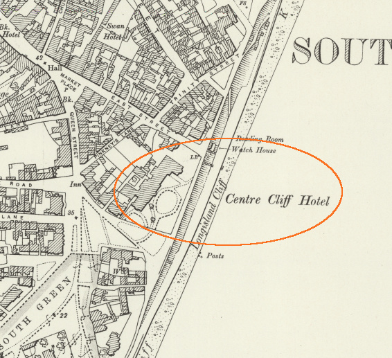
It's shown on this old OS map from about the end of the 19th century. interactive map
In 1900 this was described as "a charming hotel situated in its own grounds, extending to the sea the new wing (erected in 1899) consisting of an additional 30 bedrooms (nearly all with a sea view) & spacious hall 60 feet by 30 feet, enables the management to give an increased advantage to visitors. Bus to all trains; golf links within 3 minutes walk".
It was used by the army in World War Two and later converted into flats.

Gallery


 Lord Nelson 0.02 mile
 Red Lion 0.06 mile
 Swan 0.10 mile
 Sole Bay Inn 0.13 mile
 Crown 0.14 mile
 Boardwalk 0.42 mile
Landlords
(Most pub, location & historic details collated by Nigel, Tony or Keith - original sources are credited)
(some old PO directory information courtesy of londonpublichouse.com)
Old OS map reproduced with the permission of the National Library of Scotland.
