


Hawstead Bull

listed building grade II
last updated May 11th, 2022.
Something we've got wrong about this establishment? Something more you think we should know about it? Please email us
Hawstead Bull
East, 52.20146,0.70236
 Closed: between 1840 and 1920
Bull Ln
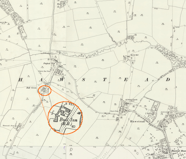
grid reference TL 847 593
It's shown on this old OS map from about the end of the 19th century. interactive map
The building dates from the late 16th century and was extended in the 18th.

Gallery


 White Horse 1.47 miles
 Beehive 1.93 miles
 Six Bells 1.99 miles
 Rushbrooke Arms 2.0 miles
 Macebearer 2.3 miles
 Spread Eagle 2.6 miles
Historical interest
A report in the Bury & Norwich Post, October 17th 1899**, states that a Full indoor licence granted had been granted to the Bull.
In 1937 the pub is listed in Kelly's Directory as one of 220 pubs that was retailing beer that they were brewing.
Landlords
(Most pub, location & historic details collated by Nigel, Tony or Keith - original sources are credited)
(** historic newspaper information from Stuart Ansell)
Thanks to Andy Parrett for supplying a photo of the pub when it was open.
Old OS map reproduced with the permission of the National Library of Scotland.
