


Yaxley Red Lion

listed building grade II
last updated Jul 18th, 2024.
Something we've got wrong about this establishment? Something more you think we should know about it? Please email us
Yaxley Red Lion
also traded as Lion
West, 52.32215,1.10992
 Closed: between 1920 and 1970
last owner/operator: Lacon's Brewery
Ipswich Rd
grid reference TM 120 738
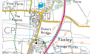
It can be seen on this old OS map from about the end of the 19th century. interactive map

Now Lyon House, the building dates from the early 17th century. The date of closure is unknown, but was almost certainly after 1946, as it is shown on an OS map of that year.
Gallery


 Cherry Tree 0.29 mile
 Railway Tavern 1.33 miles
 Queen's Head 1.51 miles
 Oaksmere Hotel 1.87 miles
 White Horse 1.90 miles
 Four Horseshoes 2.2 miles
Landlords
(Most pub, location & historic details collated by Nigel, Tony or Keith - original sources are credited)
(some old PO directory information courtesy of londonpublichouse.com)
(1861 census information from Malcolm Fairley)
Old OS map reproduced with the permission of the National Library of Scotland.
